

Introduction
The Mauryan Empire, established around 321 BCE, was one of the largest political entities in ancient South Asia. Under its greatest ruler Ashoka (ruled around 268–232 BCE), the reach of Mauryan power touched most parts of the subcontinent. Yet, the strength and form of Mauryan rule differed across the vast areas covered by the empire.[1] This brings us to the question: How could the rulers of Pataliputra rule territories that were located several hundred or even thousand kilometres away from the centre of their power?
The Mauryan state did not have any communications network comparable to modern times. The knowledge about communication within the Mauryan Empire is limited to various evidences in the inscriptions, literature and archeological findings. In this case, it is necessary to separate between facts that we know from the sources and those that we might conclude from them.[2]
Roads, officials, messages and inscriptions seem to create several systems that made it possible to communicate information and order people. Although these means of communication were not organized as a network, collectively they facilitated the connection of the centre of the Empire to remote territories.
The Great Routes: Uttarapatha and Dakshinapatha
Two significant routes that connect the vast empire include the Uttarapatha or northern route, and the Dakshinapatha or southern route.
While the Uttarapatha was the route connecting the northwest part of the Indian subcontinent, such as Taxila and the Punjab region with the Gangetic core and routes further to Pataliputra, the Dakshinapatha connected the Gangetic region with central India and the Deccan as well as to the south. These were certainly not the roads built by the Mauryas themselves. Instead, these were earlier-established corridors of movement that facilitated connectivity between various regions through trade and interaction, and were then used within the Mauryan network.[3]
Greek descriptions in association with Megasthenes also mention a Royal Road, as well as means of measuring distances. However, a lot of Megasthenes’ Indica survived due to later writers, so these sources can be used as an additional source, yet carefully, as evidence of the communications network.[4] The Arthashastra also provides some information on roads, trade routes, as well as on the southern road. However, there are still debates regarding the date and authorship of this work, and it is possible that at least some parts of it may have been created after the Mauryan period. Therefore, one would better rely on it as a source of theoretical knowledge regarding governance and administration.[5]
Direct evidence, which can be seen in the inscriptions left by Ashoka himself, are provided in Pillar Edict VII. Here, Ashoka mentions the planting of trees and creation of wells along the roads, presenting it as one of the ways of showing concern of the king for people and travelers.[6]
The Rajukas: Officials Connecting Centre and Periphery
In addition to the roadways, there were other aspects of the Mauryan communication system, one of which was officials that would travel in the empire and communicate with the population in those regions.
For example, Rock Edict III mentions that the Yuktas, Rajukas and Pradesikas should tour the whole empire every five years to teach Dhamma, as well as for other official affairs. So, from this inscription, we can get direct evidence of a system where senior officials had to move across the imperial realm on a regular basis.[7]
From the Pillar Edict IV, we know more about the Rajukas. Ashoka mentions that they were officials responsible for ruling large populations and had the freedom of rewarding and punishing people. Therefore, they were definitely important administrative officials, and not just messengers or communication officers.[8]
It might be tempting to call them a part of the Mauryan “communications network,” but there is no direct evidence of it. There is also some uncertainty about their origin and title. However, what we can say for sure is that Rajuka’ tours allowed officials from the imperial centre to communicate with populations in distant locations. Officials, while traveling, did not just carry instructions from the centre to the edge. They also learned about local conditions and ruled the empire administratively and judicially. These circuits thus provided a chance for local information to pass through the imperial administration, even though no inscriptions describe this process.[9]
In modern parlance of strategic communication, one can see it as a two-way exchange of information between the centre and the population. However, such terminology is an analysis of the situation, and not a term applied in its own right by the Mauryan sources.[10]
Some other officials and regional centres helped link distant areas with the empire administration. Taxila, Ujjain, Tosali and Suvarnagiri were some of the centres of Mauryan administration. It is possible that such centres helped reduce the administrative distance between Pataliputra and the remote parts of the empire.[11]
What Moved Along These Networks?
Communication infrastructure only acquires meaning when seen in conjunction with what flows through it.
Information was the first and the most obvious thing which travelled through such a network. Orders from the central authority had to be delivered to various officials, while reports from these same officials on the situation locally were to travel in the reverse direction. Arthashastra is not a guidebook of Mauryan practices, even though it gives us useful information regarding some systems of messengers, spies and administrative reports.[12]
The second thing which travelled through such a system was people themselves.[13]
Thirdly, there was the military movement. Troops, goods, and equipment also required routes in the empire. The exact system of military logistics of the Mauryan period is not easy to establish and large numbers in some Greek sources about this should not be accepted at face value. While the surviving evidence does not provide us with detailed information about military logistics of the Mauryan period, it is safe to assume that major routes that were used for administration and trade might also serve for the movement of the army and its logistics.[14]
Thus, the same infrastructure could have a number of different purposes: administration, trade, diplomacy, and military actions.
Inscriptions as Imperial Communication
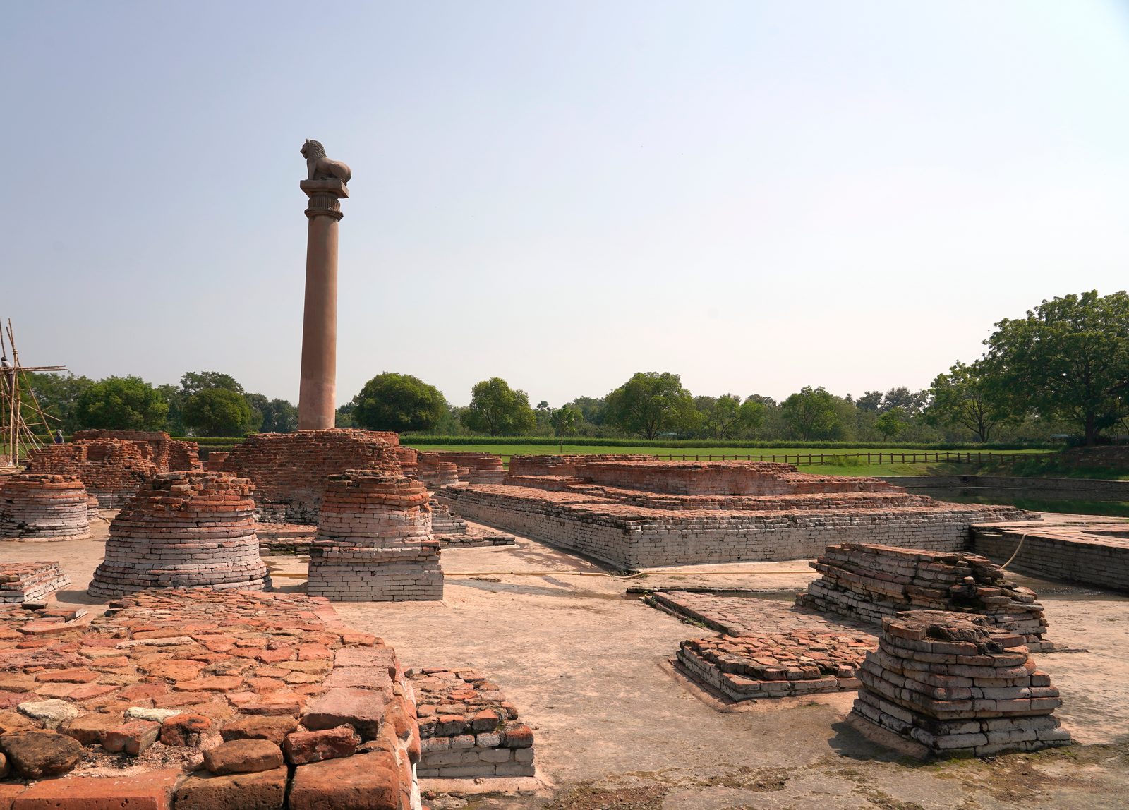
The most visible evidence for strategic communication of the Mauryan Empire can be seen in the inscriptions left by Ashoka.
Edicts of Ashoka were inscribed on stones and columns in different parts of the empire. Most of them were written in the Prakrit language using Brahmi script, but inscriptions in the north-western part of the empire were written in Kharoshthi. In addition, in Kandahar inscriptions were made both in Greek and Aramaic languages. Thus, we see adaptation of these texts to different regions of the empire.[15]
These inscriptions turned the words of the king into public messages. They were not administrative texts, but statements aimed at people from different parts of the empire.
Their location is especially important. A lot of inscriptions were erected in strategically important places such as regions linked to settlements, paths and regional centres, although it is debatable how the specific inscriptions were selected for particular locations.
The inscriptions show adaptation as well. As Rock Edict XIV states, the text was created in shortened, intermediate and full forms, as well as everything not mentioned everywhere. In fact, it gives very clear evidence that the communication of Ashoka was adapted to the situation and not replicated in identical form throughout the empire.[16]
Importance of the inscriptions is due not only to their content, but also in the way in which they communicate the message of Ashoka. The king used a natural landscape as a media for reaching the desired regions and audiences.
Communication, Mobility and the Limits of Imperial Control
The Mauryan Empire was not a centrally controlled area in contemporary meaning. The scholars have noted the unequal character of the Mauryan rule. The core region of Magadha may have been under more direct rule, while the distant regions could have had different types and degrees of imperial power.[17]
This increased the importance of communication all the more.
The farther away the region was from Pataliputra, the more difficult it was for the orders to be passed on and reports received. Roads and regional centers served to bridge this gap and traveling officials created a link between the center and the local populations from time to time. The other means by which royal power could be extended outside the capital were the inscriptions.[18]
Such may be the case with regard to the strategically and economically important areas as well. The region of Suvarnagiri, associated traditionally with the “golden mountain” is mentioned in the literature as connected with the southern Mauryan administration. Location of Suvarnagiri has been a matter of discussion in connection with the resource rich regions of the Deccan. Identification of Suvarnagiri and the level of economic administration in this area remains controversial.[19]
The other example that could be given in this context is that of Kalinga. Following the conquest of Kalinga, Ashoka issued inscriptions at Dhauli and Jaugada which were meant to deal with the issues of administration of the new province and behavior of its officials. The Dhauli edict is directed to the high officers in Tosali, while the Jaugada edict – to the officials in Samapa. Thus the inscriptions show that following military conquest there should be a constant process of communication in the administration of the conquered territory.[20]
Territory could be won militarily, but it should be governed by means of communication with officials and the population.
Conclusion: Distance as a Strategic Problem
There were several points in the governance of the Mauryan Empire worth emphasizing.
First of all, the order from the centre should have been delivered. The orders issued in Pataliputra did not have any impact if they could not reach the regions far away from the centre. Secondly, there was a need for mobility. There were roads, administrative centers, officials and messengers through whom the communication happened.
Finally, communication had its boundaries, since it was impossible to implement the same level of control over the empire due to distance and geographical and administrative obstacles.
Thus, the Mauryan communication system did not represent one designed system, but rather the interconnection of routes, administrative institutions and inscriptions.
Mauryan lessons must be viewed in the light of history rather than being seen as the template for modern statecraft. What is evident, though, is that for an ancient empire of this size, strategic communication was not distinct from power itself but was part of the process of wielding it. Army conquests would be followed by construction of roads and channels of communication, and thus the conquered territory would be manageable.
This way, the problem with which the Mauryans were faced was not just one of moving armies over distances but of moving power, information, and intentions.
Notes
[1] Romila Thapar, Aśoka and the Decline of the Mauryas, rev. ed. (Delhi: Oxford University Press, 1997). The 1997 revised edition is documented by library catalogues.
[2] Upinder Singh, A History of Ancient and Early Medieval India: From the Stone Age to the 12th Century (Delhi: Pearson Longman, 2008).
[3] Kosambi, An Introduction to the Study of Indian History; Singh, A History of Ancient and Early Medieval India.
[4] J. W. McCrindle, Ancient India as Described by Megasthenes and Arrian (London: Trübner, 1877).
[5] Kautilya, The Arthashastra, trans. R. P. Kangle (Delhi: Motilal Banarsidass, 1960).
[6] Aśoka, The Edicts of Asoka, ed. and trans. N. A. Nikam and Richard McKeon (Chicago: University of Chicago Press, 1959), Pillar Edict VII. The bibliographic details of this edition are confirmed by the University of Chicago Press and library records.
[7] Aśoka, The Edicts of Asoka, Rock Edict III.
[8] Aśoka, The Edicts of Asoka, Pillar Edict IV.
[9] Aśoka, The Edicts of Asoka, Rock Edict III and Pillar Edict IV.
[10] Aśoka, The Edicts of Asoka, Rock Edict III and Pillar Edict IV. The phrase “strategic communication” is a modern analytical formulation rather than terminology from the inscription.
[11] Singh, A History of Ancient and Early Medieval India; Thapar, Aśoka and the Decline of the Mauryas.
[12] Kautilya, The Arthashastra.
[13] Singh, A History of Ancient and Early Medieval India.
[14] Singh, A History of Ancient and Early Medieval India.
[15] Aśoka, The Edicts of Asoka; Richard Salomon, Indian Epigraphy: A Guide to the Study of Inscriptions in Sanskrit, Prakrit, and the Other Indo-Aryan Languages (New York: Oxford University Press, 1998).
[16] Aśoka, The Edicts of Asoka, Rock Edict XIV. The University of Chicago Press describes the volume as including a section specifically on Rock Edict XIV and the adaptation of the edicts to circumstances.
[17] McCrindle, Ancient India as Described by Megasthenes and Arrian; Singh, A History of Ancient and Early Medieval India.
[18] Aśoka, The Edicts of Asoka, Rock Edict III; Singh, A History of Ancient and Early Medieval India.
[19] Singh, A History of Ancient and Early Medieval India; Thapar, Aśoka and the Decline of the Mauryas.
[20] Aśoka, The Edicts of Asoka, Separate Rock Edicts at Dhauli and Jaugada.